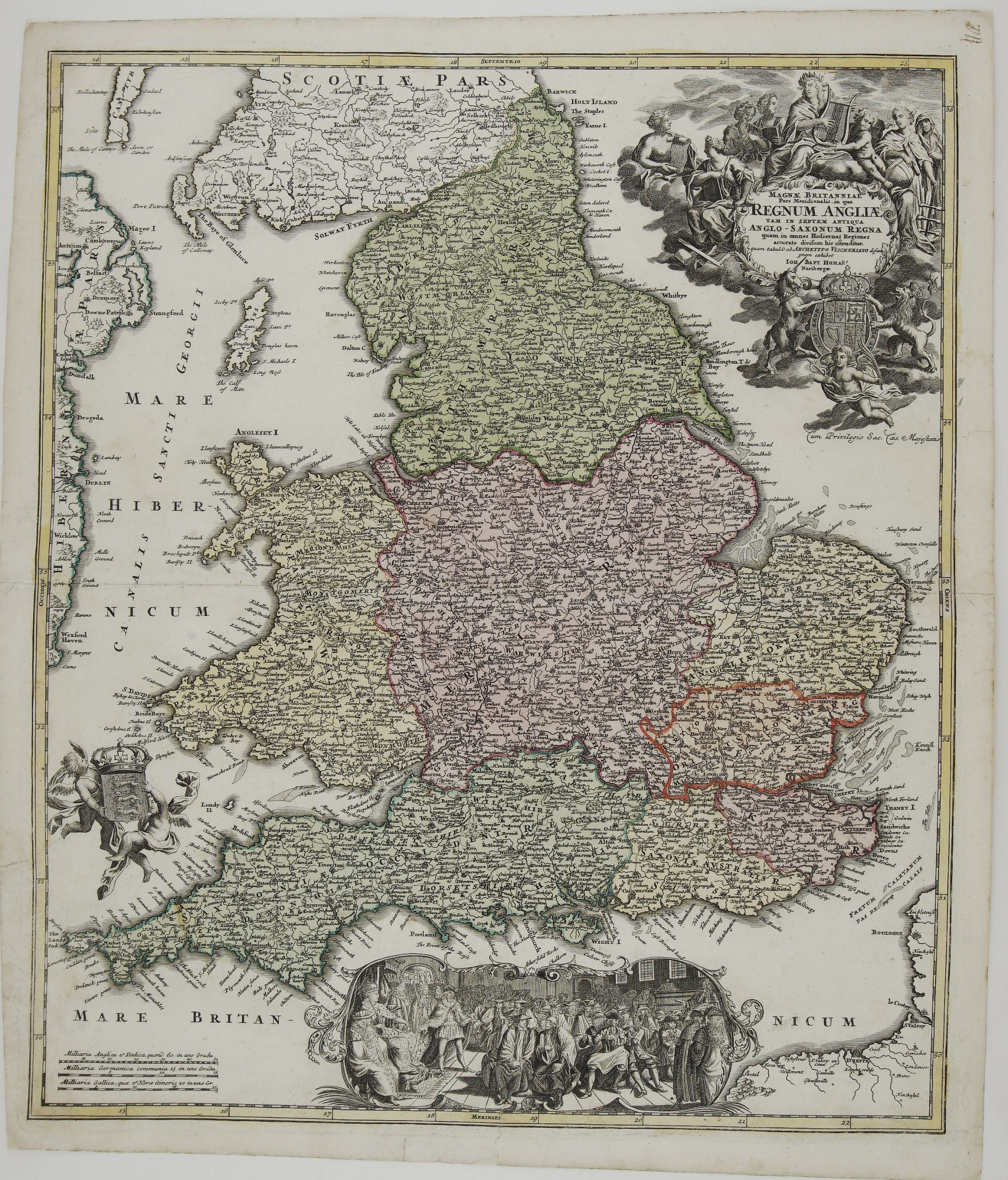
Title: “Magnae Britanniae Pars Meridionalis, in qua Regnum Angliae tam in Septem Antiqua Anglo-Saxonum Regna quam in Omnes Hodiernas Regiones Accurate Divisum hic Ostenditur…” Description: Very decorative map of England and Wales based upon N. Visscher’s map of 1695 showing the boundaries of the eight Anglo-Saxon kingdoms. The map is decorated by a beautiful cartouche surrounded by angels and the British coat of arms. At bottom is a large vignette of the Queen Anne holding court. The First state. Comes from Johann Baptist Homann atlas “Grosser Atlas über die ganze Welt” published in Nürnberg, circa 1730. Cartographer: Johann Baptist Homann (1664-1724) Sheet size: 61.3 x 51.3 cm Year: c. 1730 Technique: copper engraving Condition: Good condition. Contemporary hand coloring. Few splits professionally restored. This is an original antique map published circa 1730 and NOT a modern copy or reprint On your request we will provide a Certificate of Authenticity