


-10%
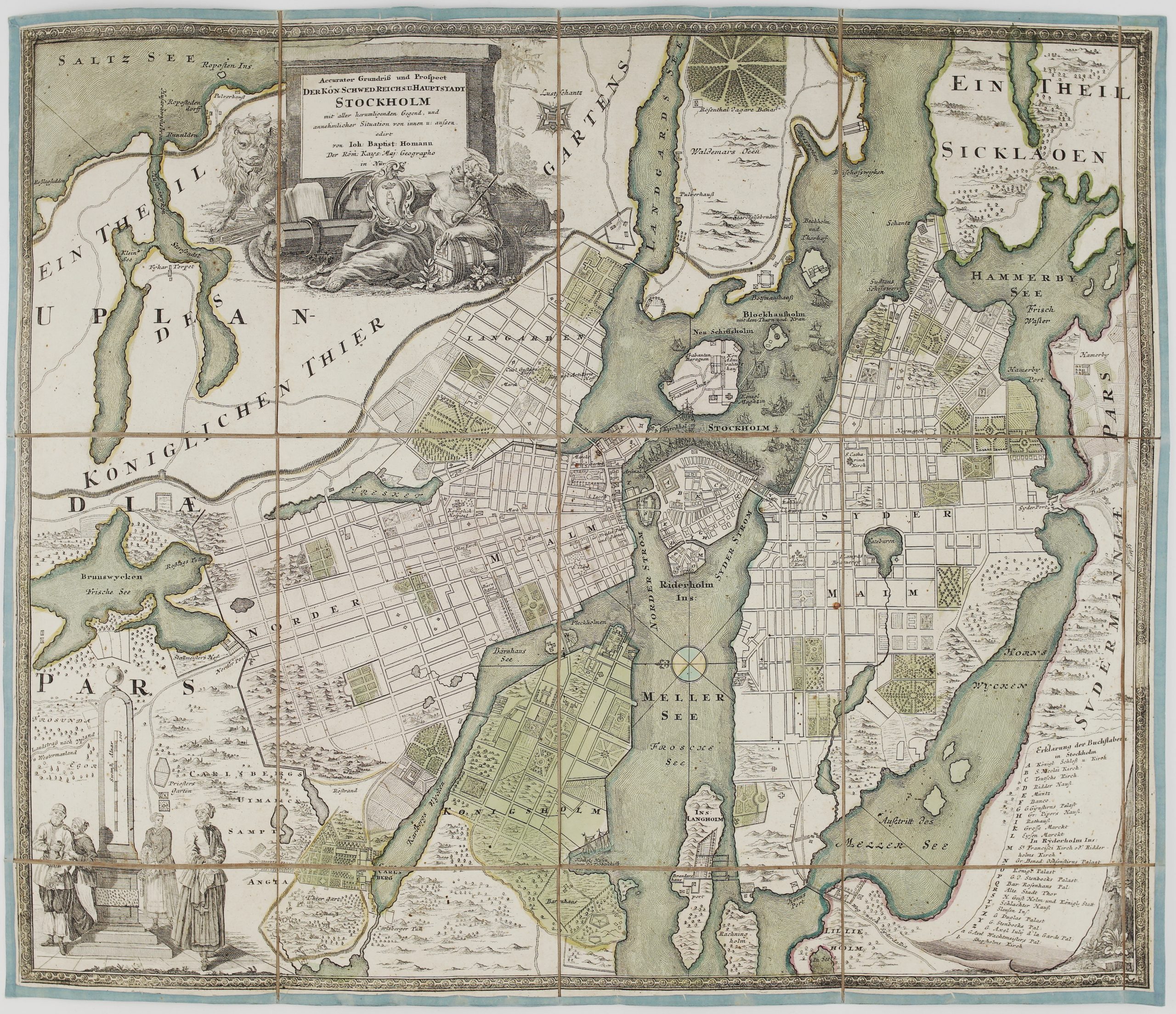
1729 – J. B. Homann – Stockholm
$ 59.83
Available on backorder
- Title: “Accurater Grundriss und Prospect der Kon. Schwed. Reichs u. Hauptstadt Stockholm mit aller herumlaufenden Gegend, und annehmlicher Situation von innen u. aussen…” Description: A detailed folding map of Stockholm featuring the Swedish capital’s streets, gardens, fortifications, animal park at bottom right, numerous ships, some engaged in battle, are depicted near Riddarholmen. The map features 28 alphanumeric points of interest, corresponding to a key in the bottom right corner. At top is a decorative title cartouche featuring Cybele, the goddess of towns, a lion symbolizing Sweden and weaponry. Map comes from Johann Baptist Homann atlas “Grosser Atlas ueber die ganze Welt“ published in Nuremberg 1729. Cartographer: Johann Baptist Homann (1664-1724) Sheet size: 59,0 x 50,0 cm Year: 1729 Technique: copper engraving Condition: Good condition, original hand coloring. This is an original antique map published in 1729 and NOT a modern copy or reprint On your request I will provide a Certificate of Authenticity
Related products
-17%