


-10%
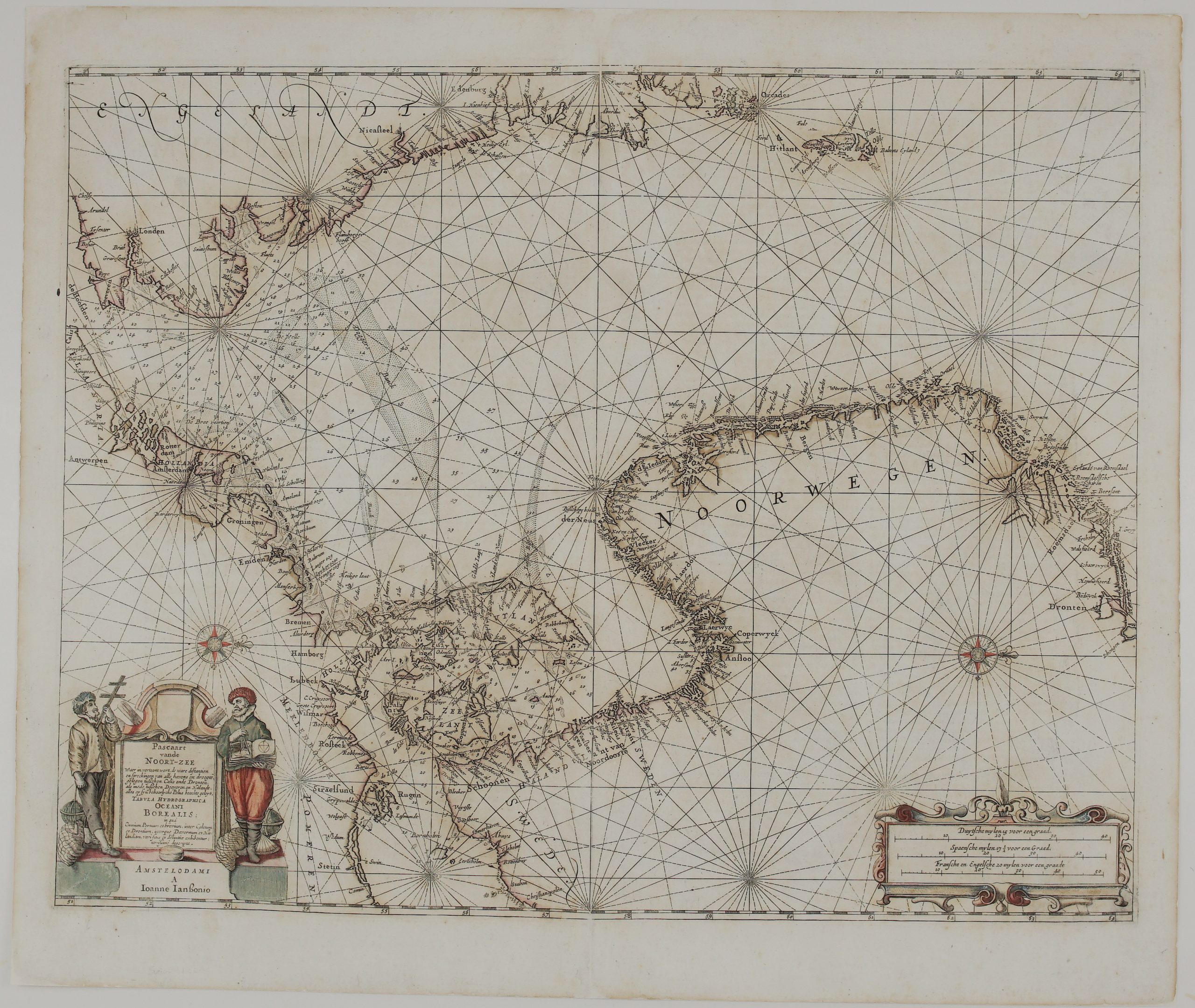
1650 – J. Janssonius – Pascaart vande Noort-Zee
$ 49.42
Available on backorder
- Title: “Pascaart van de Noort-Zee waer in vertoont wort, de ware distantien en streckingen van alle havens en droogten gelegen tusschen Calis ende Dronten, als mede tusschen Doeveren en Hitlandt, alles op syn behoorlycke polus hoochte geleyt. – Tabula hydrographica Oceani Borealis in qua omnium portuum et brevium, inter Caletum et Drontium interque Davernum et Hitlandiam, veri situs et distantiae exhibentur, novissime descripta” Description: Rare see chart of the North Sea region, extending from Shetland and Orkney Islands, Scotland and England east coast, the North Sea coast, Netherlands and Germany, the Baltic Sea with coast of Sweden, Denmark, Poland and the Atlantic coast of Norway. North is oriented to the right. Published by Johannes Janssonius in Latin edition atlas “Novus Atlas”, Amsterdam, 1650. Cartographer: Johannes Janssonius (1588 – 1664) Sheet size: 59,5 x 50,4 cm Year: 1650 Technique: copper engraving Condition: Good condition. Watermarked paper. Contemporary coloring. Few restorations on verso, due to green color oxidation. This is a genuine antique map published in 1650 and not a modern copy or reprint On your request I will provide a Certificate of Authenticity
Related products
-15%
-21%