


-10%
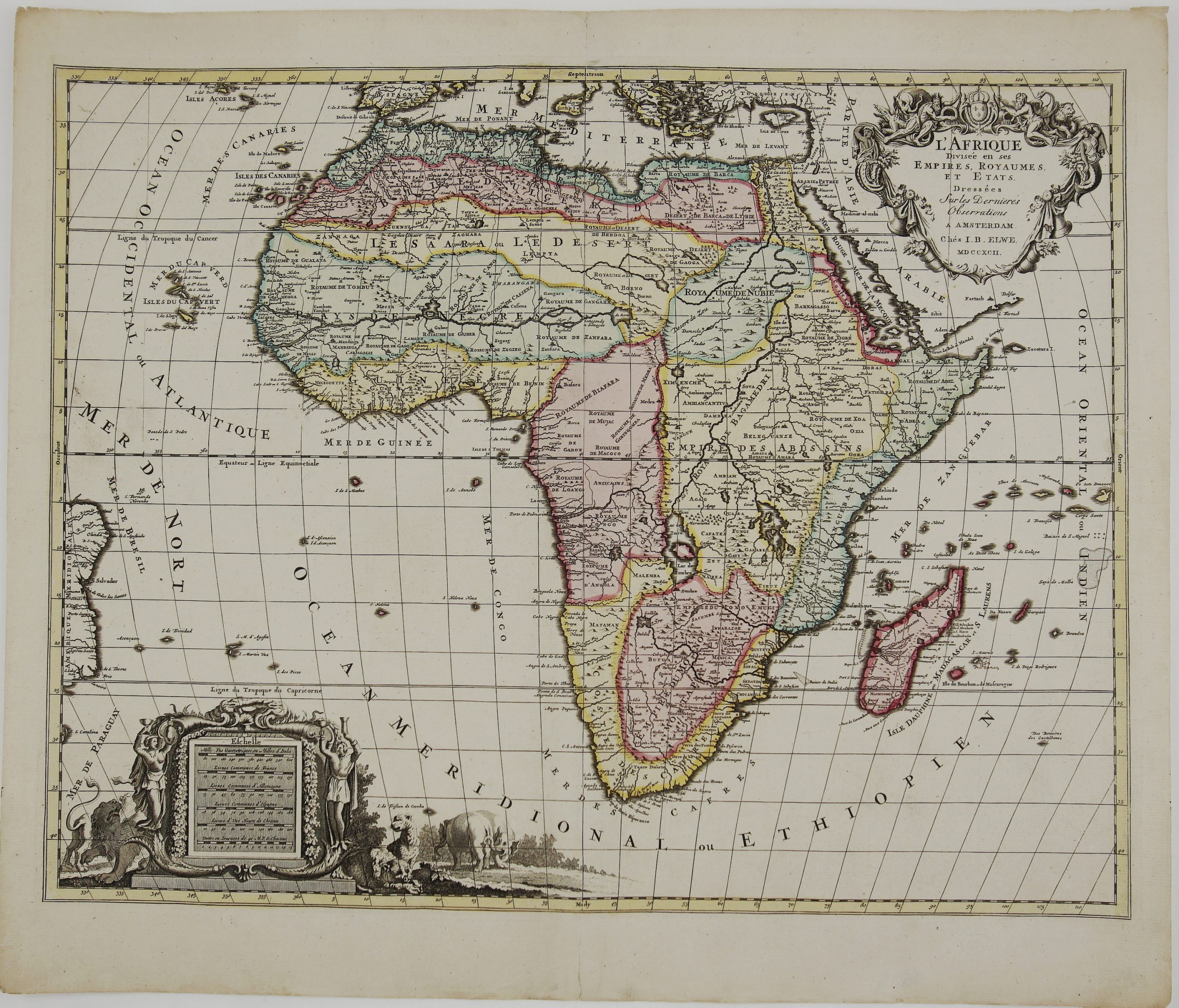
1792 – J. B. Elwe – L’Afrique
$ 48.31
Available on backorder
- Title: “L’Afrique Divisee en Ses Empires, Royaumes, et Etats, Dressees sur les Dernieres Observations” Description: Decorative and large map of Africa continent, based on Jaillot’s map first published on 1674. The cartography is typical for the 17th century with the Nile originating the two large, sub-equatorial lakes described by Ptolemy. The River Zaire (Congo) also arises from Lake Zaire. The Kingdom of Monomotapa is shown with its capital on the Rio de Spirito Santa. The map is embellished with two elaborate cartouches. Comes from Jan Barend Elwe atlas “Atlas Geographique et Universel ” published in Amsterdam, 1792. Cartographer/Publisher: Jan Barend Elwe Sheet size: 63,1 x 53,5 cm Year: 1792 Technique: copper engraving Condition: Good, original condition. Watermarked paper. Centerfold separation restored in margin. Contemporary coloring. Wide margins. This is an original antique map published in 1792 and not a modern copy or reprint On your request I will provide a Certificate of Authenticity