


-10%
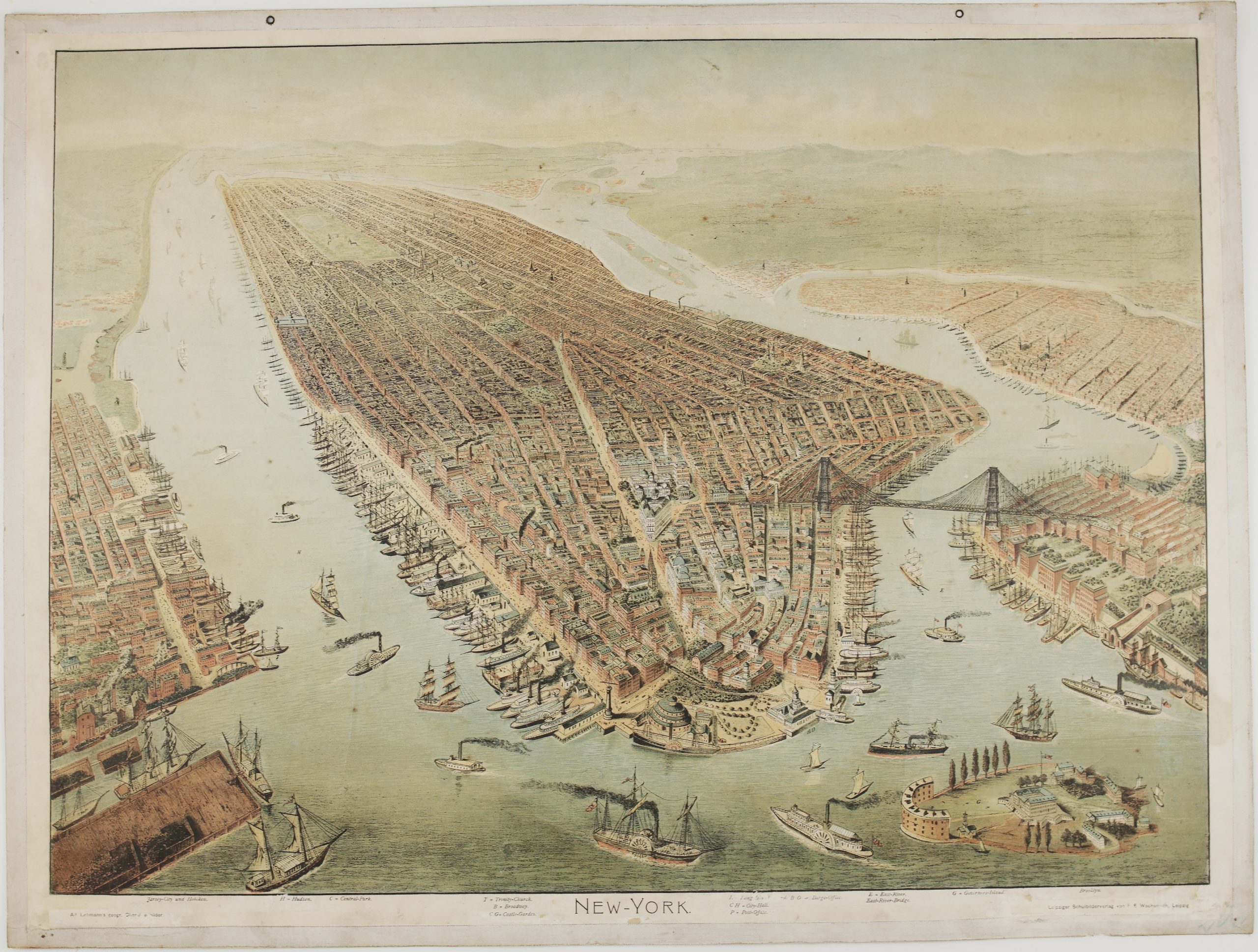
1898 – F. E. Wachsmuth – New-York
$ 51.92
Available on backorder
- Title: “New-York” Description: Very rare large bird’s eye view of New York City, produced for use in German schools, attributed to Mathieu Molitor and published by F. E. Wachsmuth in Leipzig. The view shows Manhattan Island and environs looking to the Northeast, Governor’s Island, Battery Park, City Hall and Park, Central Park, Brooklyn Bridge – still the only Bridge into the city across the East River. Publisher: F. E. Wachsmuth (1870 – 1910) Sheet size: 88,2 x 66,7 cm Year: 1898 Technique: chromolithograph Condition: Good condition. Couple tiny repairs in water line. This is an original antique map published in 1898 and NOT a modern copy or reprint On your request I will provide a Certificate of Authenticity